Trials and travails of a Taiwanese-American kid in Taiwan

Thursday, December 28, 2006

Hiking near Jioufen - Part II: The imperial past.

It's amazing how many relics from Taiwan's Japanese colonial past you can find around Taipei County's Ruefang Township. The mineral wealth and spectacular seaside sights led to the development of everything from the coal mines around neighboring Pingsi Township, to the old gold mining ghost towns and imperial chalets at Chinkuashih (金瓜石).

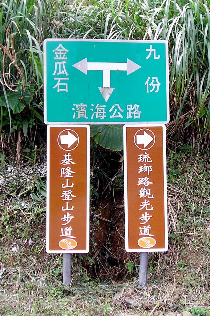
Chinkuashih is surprisingly close to Jiufen. The two towns are connected by a winding 2.5 km road that runs through the rocky hills and mountains that line the northeast coast of Taiwan. A regular bus route runs between the two for the very affordable price of NT$22 for a one way trip.

But what fun would that be?

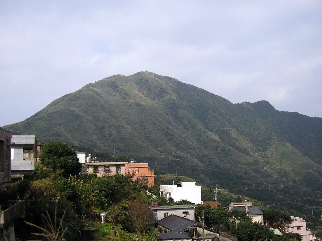
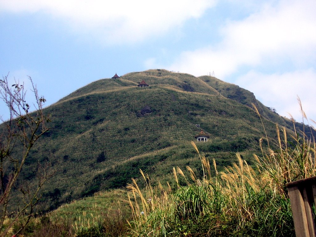
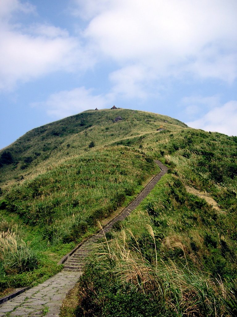
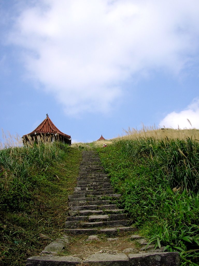
Feeling slightly giddy as I came down from Keelung Mountain, I thought it would be a good idea to walk the 2.5 km to Chinkuashih.

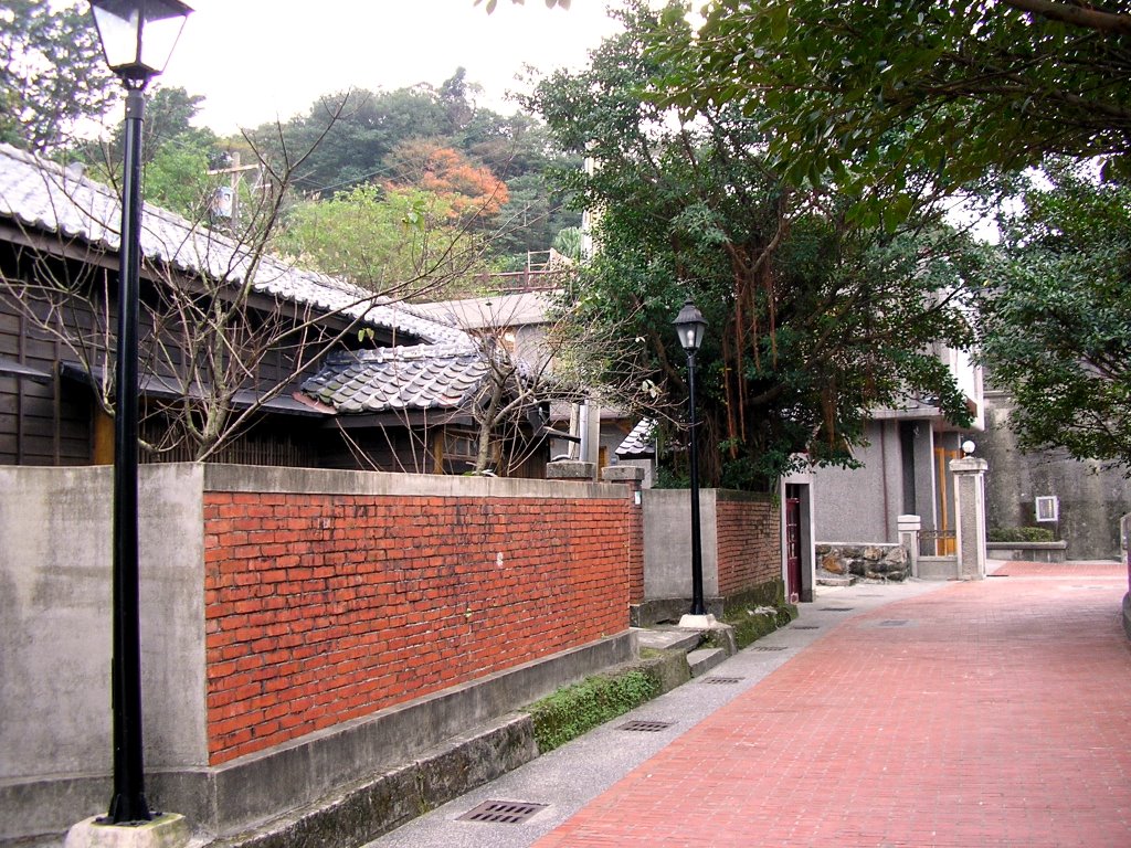
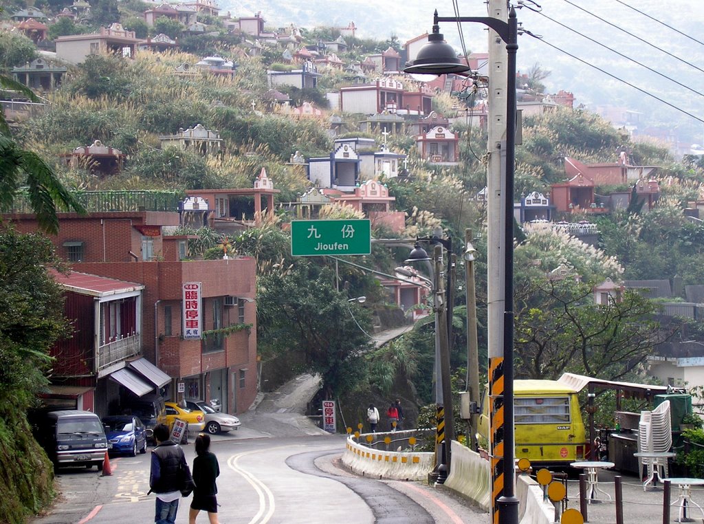
The road to Chinkuashih just outside of Jioufen. (The one below the road with the funeral procession. How very auspicious.)

Many of us tend to think of winding mountain roads in Taiwan - especially those along the northeast coast as narrow winding deathtraps filled with gravel trucks roaring around blind turns at breakneck speeds. I didn't see any kamikaze gravel trucks along the way through there were plenty of kamikaze tour buses full of Hong Kong, Singapore, and Japanese tourists. But, the fact that I am here typing this right now indicates that yes it is possible to walk a narrow mountain road in Taiwan without getting killed... maybe.
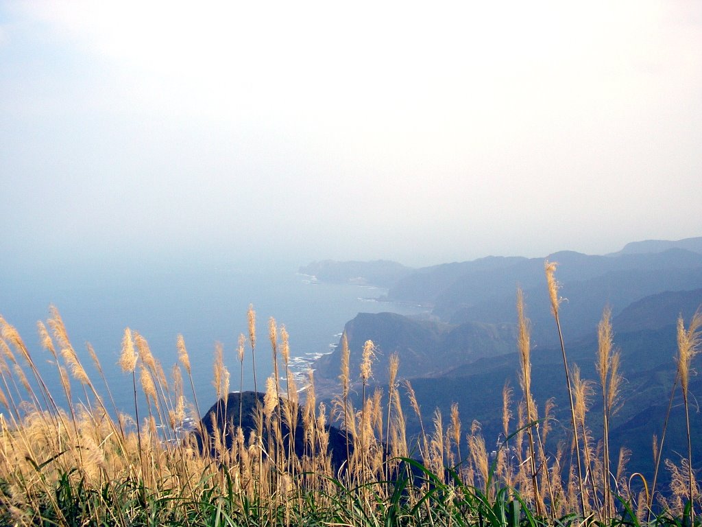
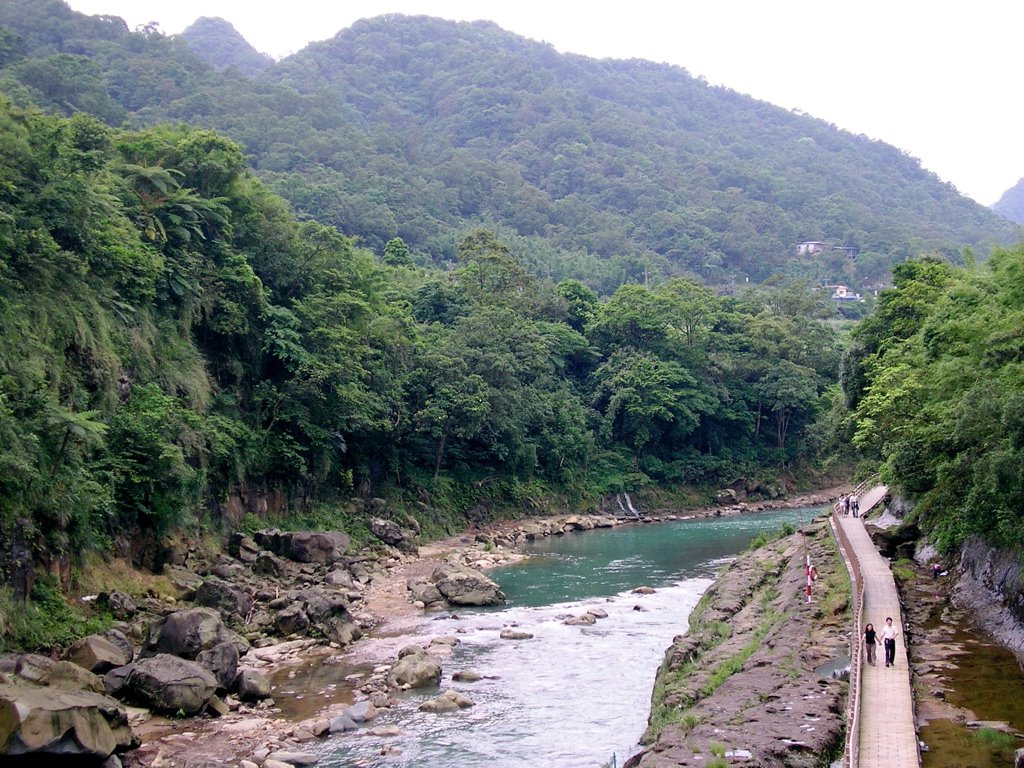
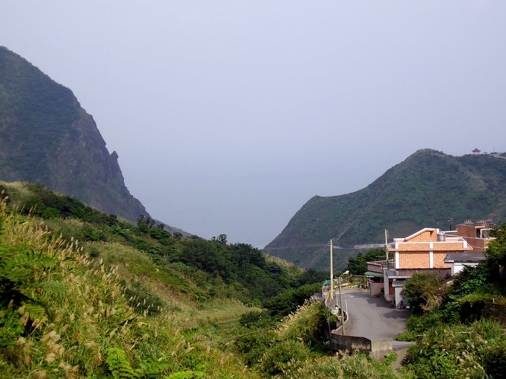
A glimpse of the ocean from the road.

"Nightclubs" line the road. Say hi to those whom the locals refer to as the 好兄弟.

Somewhere in the middle of nowhere...

... with the occasional small village...

... and coffee shop with a Zero fighter theme.

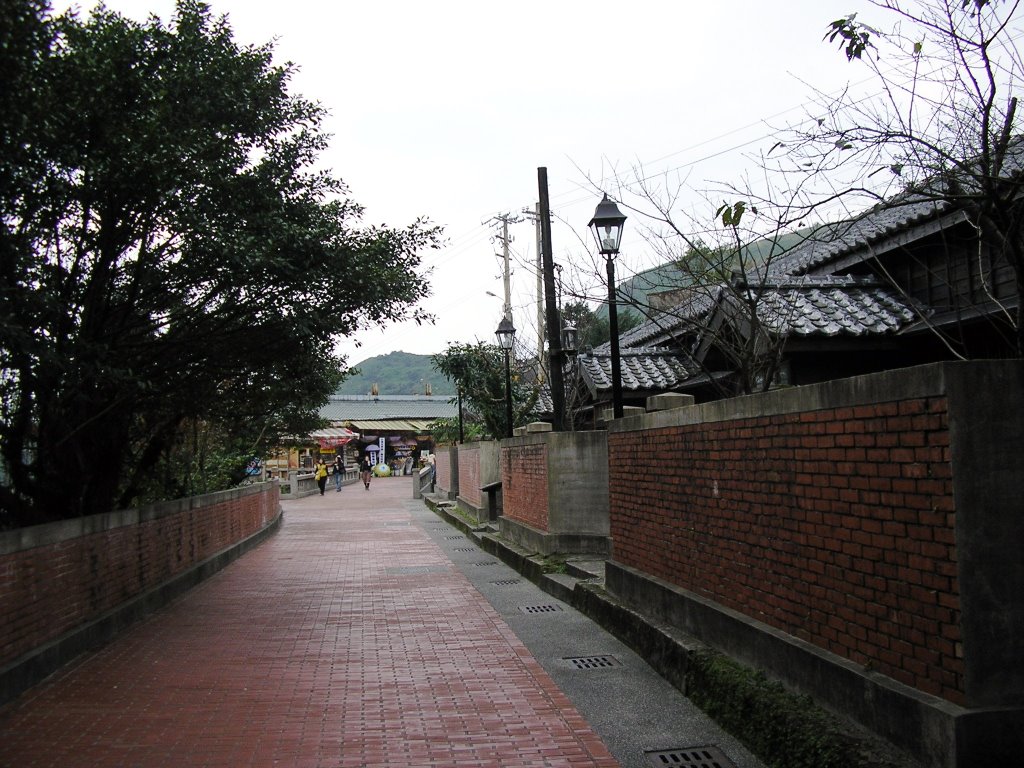
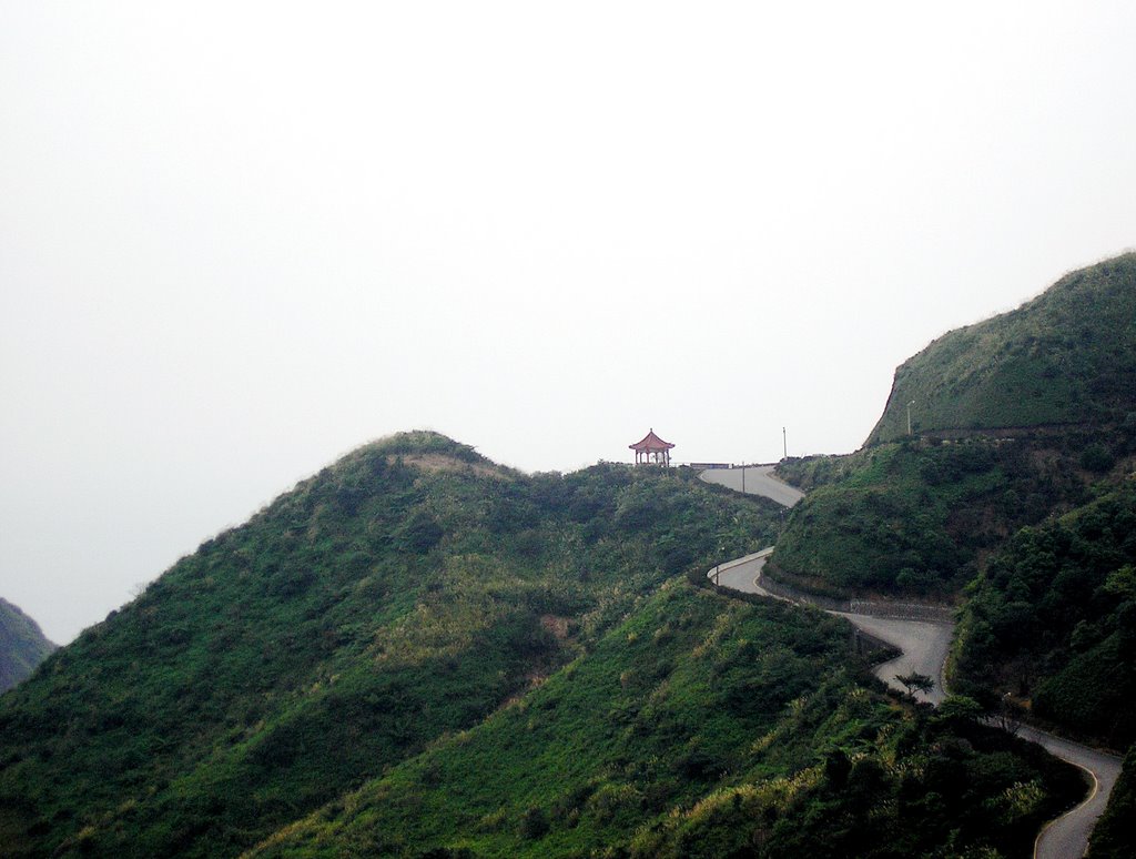
Thank god I didn't have to walk along that section.

All in all, the walk took about half an hour. It's not too bad going from Jioufen since the route is mostly downhill. Be prepared for a lot of odd looks from residents and drivers though.

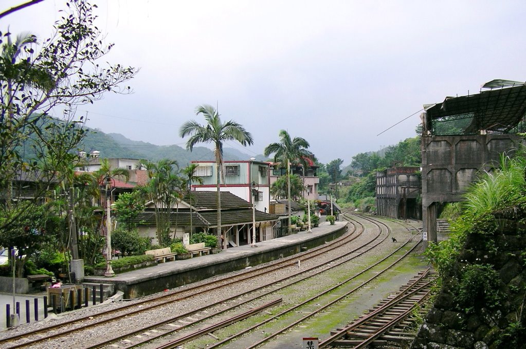
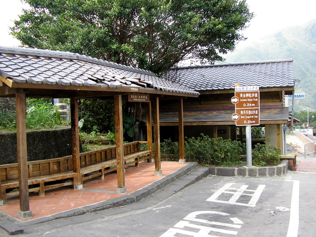
Even the bus station is retro.

The road eventually reaches the Chinkuashih bus station, located right outside the entrance to the Gold Ecological Park - a historic area complete with a museum on the old gold mining days, a restored Japanese era mining town, as well as a series of hiking trails passing through many ruins left over from the era. Considering the state of disrepair most of the old Japanese style houses in the major cities are in, it's interesting to see how they looked back when they were new. The entrance fee for the museum and exhibits is a very reasonable NT$100, though access to the park itself and the hiking trails is free.

Restored Japanese-style houses where mining families once lived.

The neighborhood koban (police box).

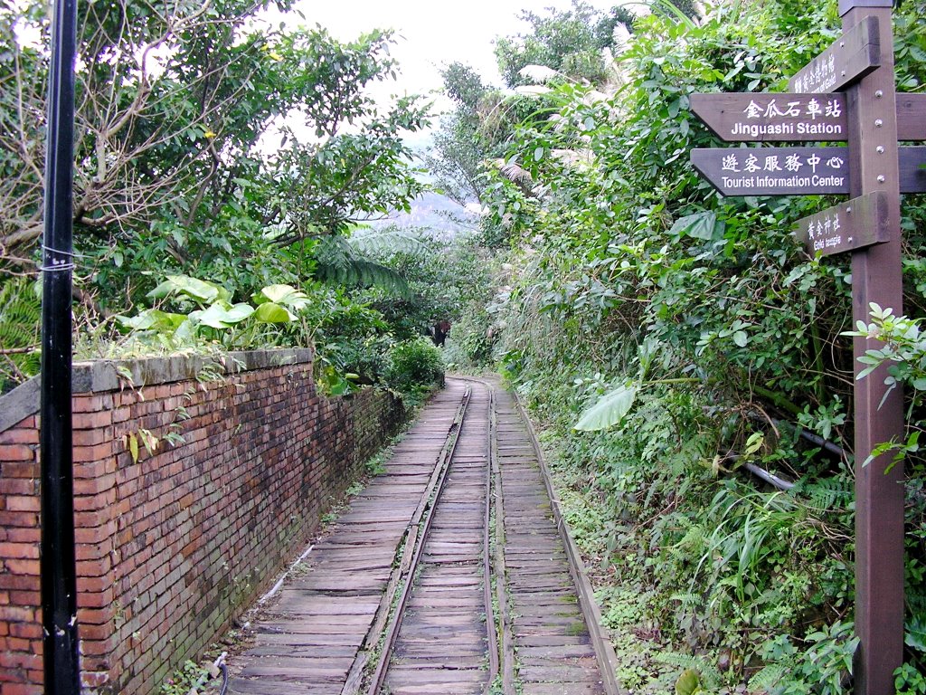
The path to the museum follows a set of narrow gauge tracks, similar to those that were once used to transport ore.
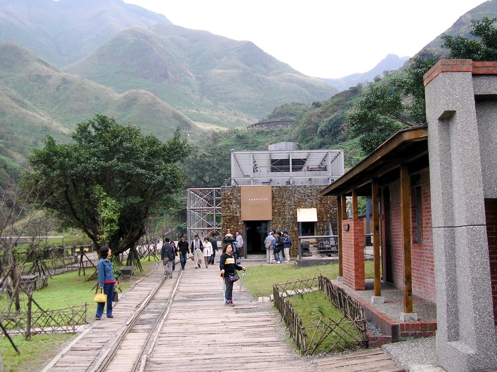
The Museum of Gold.

The area also contains many historical sites worthy of note, including a chalet which once belonged to then crown prince Hirohito, the former site of a prison camp which once held Allied POWs during World War II, and the ruins of a Shinto temple - the Ogon Jinjia (黃金神社, lit: Shrine of Gold). Regrettably due to time constraints, I only had enough time to visit the last one.

The Ogon Jinjia was constructed in 1897 and moved to its current location overlooking the town and coast below in 1933 after mining operations began on the top of mountain where it was formerly located. The temple itself was dedicated to the guardian spirits of the miners who once worked in the area, and was once surrounded by groves of cherry trees. After the end of World War II, the temple was abandoned, vandalized, and eventually burned to the ground. It is said that the cherry trees themselves also disappeared after the fire, never to return. Today, all that remains are some of the stone lanterns, gates, and the foundation.

I'm not sure if the bare blackened husks of dead trees I saw surrounding the area belonged to the cherry trees, but they certainly lent a very eery feel to the ruins. The surrounding region is very beautiful (in the damp semi-depressing sort of way so common along the northeast coast). According to the scholarly experts at Godchecker.com:

The Japanese have 800 myriads of Gods which must cause a few congestion problems on their islands.

They appear to have a tendency to worship anything if it stays still long enough and looks interesting enough. Photography has replaced Iconography and pilgrims can often be seen in London recording taxis and streetlamps for possible deification.
So it's not difficult to see why the Japanese would build a temple around here.

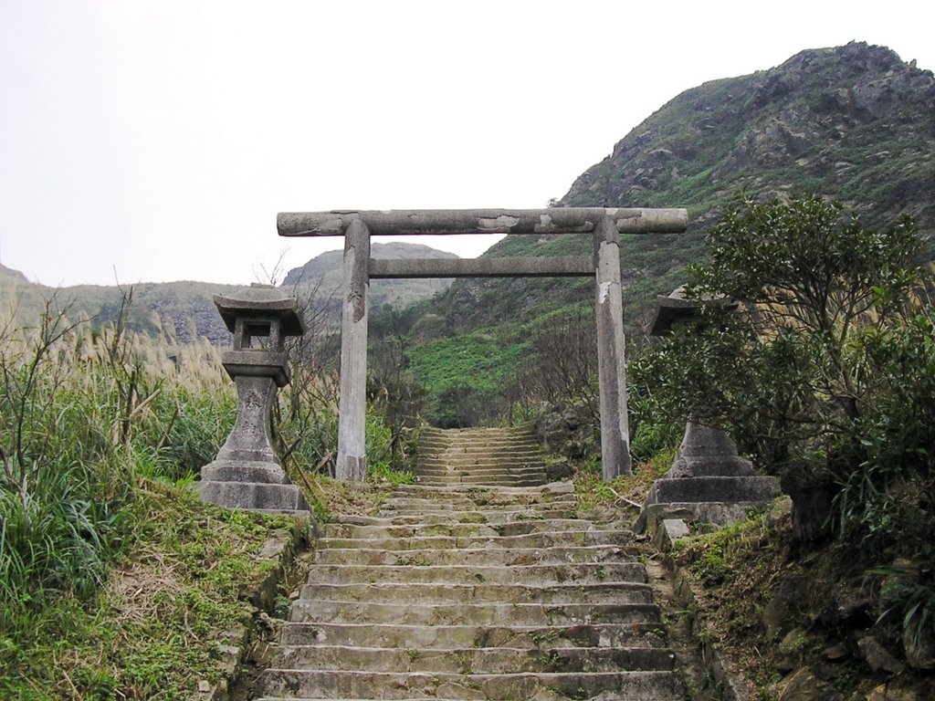
The first gate at the foot of the steps to the temple.

Dead trees flank the path to the temple. The inscription on the lanterns reads "奉納" (offering), and also appears on many of the ruins.

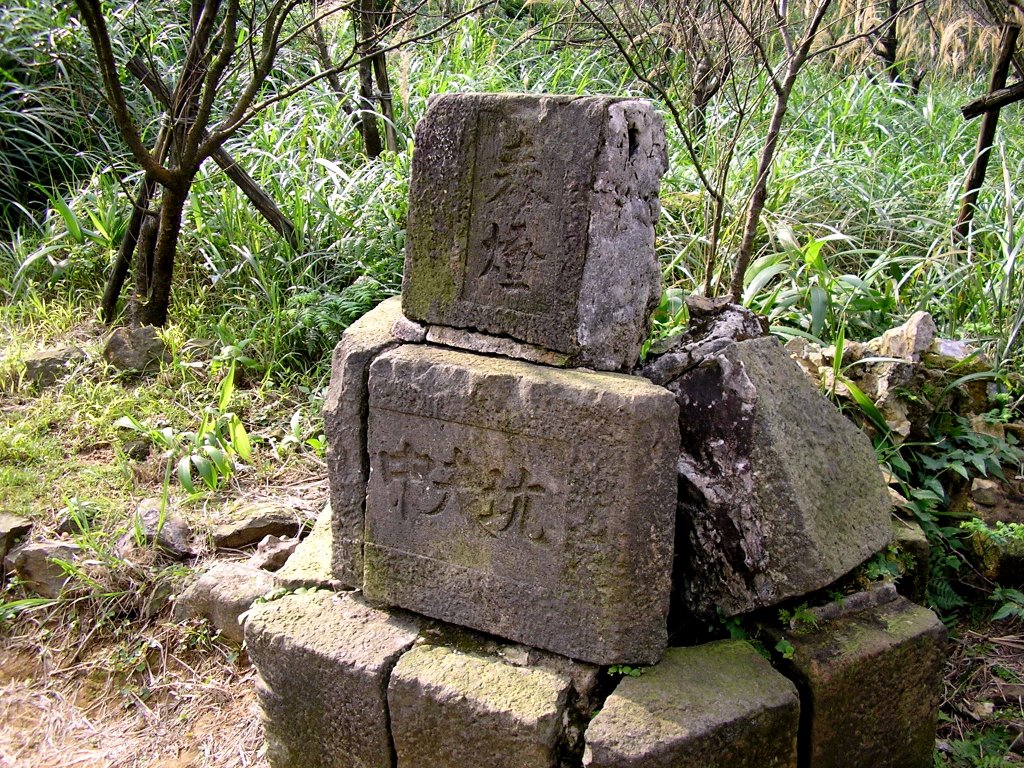
A pile of stones by the path. The inscription on the top stone reads "奉燈" (offering lamp?), while the bottom stone reads "中央坑" (central tunnel). A talisman left by the miners perhaps?
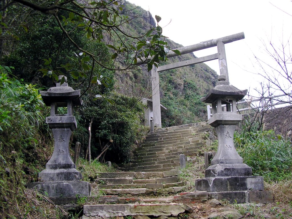
The second gate.

All that remains of the temple.

Many of the inscriptions on the gates and lanterns have been defaced.

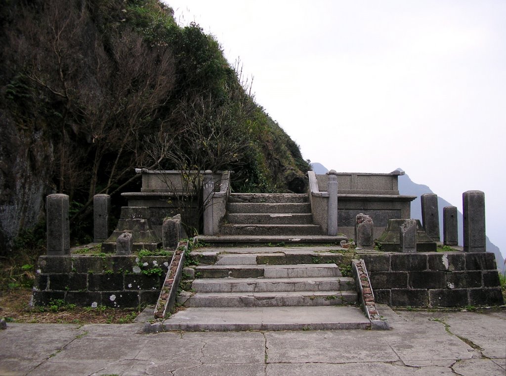
The base of the temple. For some unknown reason there is a rectangular pit about three feet deep in the floor.

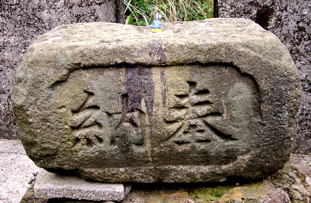
All that's left inside.


Tags: , ,

Hiking near Jioufen - Part I: Keelung Mountain

Jioufen: Where the dead reside above the living.

Pretty much everyone whose visited Taiwan since the early 90s has at least heard of Jioufen (九份), that quaint little town on the hillside overlooking the Pacific Ocean where Hou Hsiao-hsien's movie "City of Sadness" was filmed. If you haven't been there, you owe it to yourself to go at least once. The town is easily accessible from Taipei via train and bus (take the train to Ruefang (瑞芳) Station, cross the street and take the bus to Jioufen). The main tourist trap is the Old Street. A long narrow row of quaint shops and eateries harking back to the "good old days" of vacuum tube radios, wooden sandals, and rice with lard poured on top. Most visitors can spend an entire visit just walking the length of Old Street.

That is not where I went on this trip.

Keelung Mountain viewed from the road to Chinkuashih (金瓜石).

Keelung Mountain (雞籠山, elevation 587 m) is a rather steep hill outside of the town of Jioufen, just a bit further up the road from the town itself. Arriving at Jioufen by bus, most people will get off near the Old Street stop. Follow the road a bit further up and you'll find a white stone marker denoting the trailhead for the Keelung Mountain trail by the left side of the road.

The Keelung Mountain trailhead.

The trail consists mostly of a series of very long and steep cobblestone steps cut into the side of the hill with the occasional pavilion for climbers to rest their legs. The view, however, is tremendous.

Looking up from the bottom.
Going up...
Looking back.
May the gods have mercy on my knees.

After what seems like an eternity (or was it 20 minutes? I must be losing it), I finally reach the top... which is a bit anti-climatic. The summit is occupied by what I'm told is a repeater station for aviation radio traffic, as well as a small pavilion occupied by a bunch of middle aged men drinking some kind of herbal drink (福氣啦!).

But the view more than makes up for the climb. Having spent the last 12 months in landlocked Colorado, it's great to see the ocean again. Nothing like standing on a summit feeling the sea wind blow on your face while taking in the enormous expanse that is the ocean.

Looking towards the northwest. From the nearest inlet to the furthest: Shenao Bay (深奧灣), Wanghaihsiang Harbor (望海巷漁港), Badouzhi Harbor (八斗仔漁港), and in the distance: Hoping Island (和平島) and Keelung Harbor (基隆港).
One of the abandoned gold mining facilities in a nearby hill.
Looking east towards Chinkuashih and Bitoujiao.

The climb can be quite strenuous if you don't do this kind of thing normally but is a nice way to spend an hour or so. Bring plenty of water and snacks. Once you're done with the hike you have the rest of Jioufen and Chinkuashih to explore.

Stay tuned for more on hiking to Chinkuashih and exploring the remains of the old gold mining operation .

Tags: ,

Tuesday, December 26, 2006

12 months later...


Oh there's no place like home for the holidays,
Cause no matter how far away you roam,
If you want to be happy in a million ways,
For the holidays you can't beat home sweet home.

Especially after spending an hour digging your car out of a 2 foot snowdrift. Thank you Colorado Holiday Blizzard '06.

"I transited at Narita Airport, and all I got was this lousy shaber."
To be fair, I can actually use this one without waking up everyone within a 100 meter radius. Can't say that much for my old Remington.

The neighborhood is pretty much as I remembered from last year. It's election time for li-chang again so the alleys are covered in campaign flags. Some stores have opened while others have closed.
There are a bunch of new swanky looking apartment towers that weren't there last time. And for some inexplicable reason the 7-11 where I normally buy my Taiwan Beer moved next door.

Early morning on the MRT. The usual crowds... office workers in suits and ties and students headed off to school. I realize that I no longer have a student uniform to wear. Between the suits and ties, the uniformed students, and kids with baggy pants and hair even longer and shaggier than I remembered I feel a bit out of place in my jeans, t-shirt, and backpack.

An old guy come over and starts speaking to me in Japanese. This is the third time this has happened since I arrived at Taoyuan last night...

Me: "What makes you think I'm Japanese?"
Him: "Your clothes looked foreign but your hair wasn't spiked and looked too normal for an ABC."

So there you have it. Kids from overseas are discernible by their spiked and abnormal looking hair.

First things first of course. Lining up at the Immigration Office with a bunch of other students from abroad back for winter break and even more immigrants from the PRC.

Looking around, I start to wonder if I'm the only Taiwanese student studying in the US who doesn't have spiky hair and baggy pants.
Mission accomplished. Two more years before the time for boot camp rolls around.
It's good to be back, even if only for a few weeks. Time to go out and poke around the island again.

Friday, July 14, 2006

Typhoon Bilis, Part I


Taiwan is battered by numerous typhoons and tropical storms every year (usually during July until October). The 4th typhoon this year, Bilis passed through Ilan and is now well on its way toward Fujian province.

Although it's been categorized as a "weak" typhoon, Bilis is currently drenching Taiwan's south-central mountainous areas. My town, Feng-shan, has had roads leading out of the village cut off by landslides and swollen creeks (now chocolate covered rivers).

Tags:,

Friday, June 16, 2006

Deluge...


The view of Da-Ta Mountain (sacred ground to the Zou aboriginal group ) from Ren-Ho elementary school's balcony just before heavy rains poured into Taiwan from Thursday afternoon into Sunday. The rain caused landslides, blocking roads and destroying bridges island wide. The Ali-shan region was hit especially hard. Luckily, I managed to get a ride back to Taipei before the roads out of Feng-shan were sealed due to flooding!

Soil conversation, erosion and overdevelopment are major issues that I wish could be addressed by local and central authorities. Unfortunately, short-sightedness and earning the quick NT while not reinvesting back into mother nature has exacerbated the damage done to the region after Typhoon He-bo and the 9-21 earthquake.

Sunday, June 04, 2006

Looking for black gold: The Pingsi Line

I like trains. That may sound a little hypocritical coming from an aerospace engineer, but since I also happen to like ships and other means of transportation I think I'm being consistant. Though most might not have noticed, train travel in Taiwan has been on the decline ever since the 80s and 90s with the proliferation of private vehicles, freeways, and low cost air travel. Signs of the drop in long distance passenger traffic are everywhere... the TRA section of Taipei Main Station has gone from four functioning platforms to two, small stations have been closed, and till a few years ago, small rural branch lines were closed and left to slowly rust away.

The Pingsi Line (平溪線) in northeastern Taipei County is one such line that managed to avoided that fate. A narrow 15 km line of single track running along the amazingly pristine upstream segment of the Keelung River (long before it turns into the brownish funny smelling thing that Taipei-ites are farmiliar with), the line was initially built in 1912 to transport coal from the coal mines in the area. The coal ran out and the last of the mines closed in the late 80s and early 90s. For a while, it seemed the area would be doomed to total decline. When I first visited the area in 1994, I saw small tired looking towns and villages that looked to be on their last legs. Sometime around then, someone realized the tourism potential of a historic area easily accessible by bored Taipei-ites. And today, the area along the Pingsi Line is slowly reinventing itself. It may not be back at the level of its glory days or have the glamour of tourist traps like Alishan or Jioufen, but still makes a nice day trip out of Taipei for those wanting to see rural Taiwan (for now).

Interior of a Pingsi Line train at Rueifang


The Pingsi Line splits of from the main Northern Link Line near the town of Rueifang, about half an hour to 40 minutes away from Taipei by train. Coming into Rueifang Station from Taipei on one of the many commuter EMU trains that ply the rails, one of the first things you notice on the platform is one side entirely devoted to the Pingsi Line. A ticket window located right on the platform sells one day passes for the branch line allowing the bearer an unlimited number of train rides on the Pingsi Line for a single day, allowing you to transfer to the branch line without having to leave the platform. Clearly someone has been doing their homework on how not to annoy tourists.

Stopped at Shihfen Station


The Pingsi Line is served regularly by small two car diesel trains which generally run once every 40 minutes to 1 hour in either direction. Despite the fact that there's only a single line of track along most of the line, through careful timing they somehow manage to run two trains in opposite directions along the same line without any collissions (while I was there anyhow).

Pulling out of Rueifang, the grey apartment blocks of the town are soon replaced by lush green hills and craiggy cliffs. The rail line runs along a section literally cut into the side of steep slopes above the Keelung River, which is an amazing jade color (from naturally occuring algae). After a few minutes, the train pulls into Sandiaoling Station. A small station consisting of narrow platforms on either side of the rail line and a small station house... all perched on what seems to be the edge of the cliff. There is no automobile road in front of Sandiaoling Station (or so I'm told), the station can only be accessed on foot from a road on the other side of the Keelung River.

Sandiaoling Station


Just outside of Sandiaoling, the Pingsi Line splits off from the main line, following the river. Aside from the occassional house or small unmanned station (mostly consisting of a small platform and sign), there is little sign of perminant habitation along this section. The train passes through a tunnel and a few bridges, where the engineer (who you can actually watch and talk to), slows to a crawl and toots the train's whistle to warn people walking along the tracks (of which there are apparently quite a few... locals or tourists) to clear out.

One of the more famous sights is the Shihfen Waterfall, which is billed as Taiwan's Niagara Falls. It's not quite Niagara but it's nice to look at nonetheless. Unfortunetely the area aroud the waterfall was purchased by some enterprising businessman who proceeded to fence off the area so you couldn't see the falls from the train and charge tourists NT$180 a head for the privledge of entering the area to see it in person.

Uh... no thanks. If you are interested you can get off at Shihfen Station and walk to the enterance along the tracks. I prefer not to give my money to asshats like that but the walk from the station to the falls is quite scenic (and free!), and is worth doing.

The Keelung River.


Speaking of Shihfen, Shihfen Station is the big halfway point along the line. The town of Shihfen is huddled around the train tracks, coming into the station you find that the railway runs right through the middle of town right along what one might call "Main Street". Locals are accustomed to having a train running right through the middle of town. Aside for the waterfalls to which it lends its name, Shihfen is also rather famous for their 天燈 (lit: Sky Lanterns), lanterns which function like miniature hot air balloons. Around the Lantern Festival, locals and visitors will send the lanterns floating into the sky in hopes that they will bring peace and prosperity. Quite a few stores in town are dedicated to selling them.

The town of Shihfen


Remember kids, don't stand on the tracks!


Moving further up the line, the river gorge widens into a valley. After passing a few small stops and the town of Pingsi, the train finally rumbles into the last station of the line - Jingtong. An old Japanese-style wooden station house in a small town at the foot of what was once a coal mine. Several concrete structures once used to fill freight cars with coal tower over a few unused tracks.

Jingtong Station.
Under new management.


On a hill overlooking the town and the station are the remminents of an old coal mine. The largest of the old mine buildings has been converted into (yet another) cafe selling overpriced coffee. Moving further up, one finds the mineshaft itself. A grey concrete tunnel half buried in the hillside surrounded by the remminents of some old brick buildings, looking almost like a grave. The mineshaft itself still bears inscriptions made at the time of it's construction... an inscription carved above the tunnel reads: "石底大斜坑", while another on the side proudly identitifies the date of construction as "昭和十二年三月" (12th year of Showa, Third Month... or in other words, March 1938).


The old mine.

The Pingsi Line makes an excellent daytrip from Taipei, especially if you enjoy walking
around in the countryside and exploring some artifacts from some of Taiwan's older days. The area is slowly becoming more commericalized, but has yet to reach the level of some places like Alishan or Kenting.

And of course, on the way home you can stop by Keelung for some Goodies in Front of a Temple.

Tags:,,